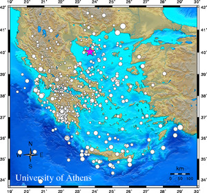
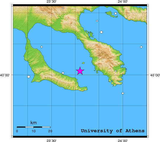
 Event-ID:    ev111027134439

 27 October 2011   (300)               Greece

 Location estimate (+/- standard deviation)
  Origin time       13:44:32.0  +/-   0.5 sec
  Latitude           40.02 N    +/-   5.7 km
  Longitude          23.70 E    +/-   6.3 km
  Depth              10.0  km   (fixed)

 Magnitudes:
  ML=0.0 (0)  ml=2.6 (19)  mB=0.0 (0)
  Median=2.6 (19)

 90-Percent confidence region ellipse:
  Semi-major axis     71.7 km  strike: 130.2 deg
  Semi-minor axis     35.7 km
  Origin time error    3.3 sec

 Autoloc alert ev111027134439: determined by 19 stations

 LocSAT solution (with start solution, 19 stations used, weight 19):

  Greece  ml=2.6  2011/10/27  13:44:32  40.02 N  23.70 E   10 km

  Stat  Net   Date       Time          Amp    Per   Res  Dist  Az ml  ML  mB
  OUR   HT  11/10/27  13:44:39.1        52.9  1.5  -0.9   0.4  34 1.8 0.0 0.0
  PROD  HA  11/10/27  13:44:58.1        37.2  1.1  -5.5   1.9 200 2.5 0.0 0.0
  DRO   HP  11/10/27  13:45:04.7        44.8  0.8  -9.0   2.6 217 3.1 0.0 0.0
  LAKA  HA  11/10/27  13:45:04.8        60.6  0.7  -4.0   2.2 217 3.1 0.0 0.0
  EFP   HP  11/10/27  13:45:05.4        32.2  1.6  -1.9   2.1 222 2.5 0.0 0.0
  UPR   HP  11/10/27  13:45:06.7         4.4  1.1  -2.9   2.3 221 1.9 0.0 0.0
  TRIZ  HA  11/10/27  13:45:06.8        35.3  1.3  -0.0   2.1 218 2.6 0.0 0.0
  KALE  HA  11/10/27  13:45:07.5        25.3  1.6   1.4   2.0 217 2.3 0.0 0.0
  KLV   HL  11/10/27  13:45:07.9        21.1  1.8  -2.1   2.3 212 2.3 0.0 0.0
  PSAR  HA  11/10/27  13:45:07.9        35.6  0.9   1.4   2.1 215 2.7 0.0 0.0
  PVO   HP  11/10/27  13:45:08.1        40.0  1.4  -0.2   2.2 231 2.6 0.0 0.0
  AXS   HP  11/10/27  13:45:08.3       129.1  0.8  -5.2   2.6 225 3.6 0.0 0.0
  PDO   HP  11/10/27  13:45:09.4        21.2  0.4  -1.9   2.4 235 3.0 0.0 0.0
  TRAZ  HA  11/10/27  13:45:09.6        22.5  1.0   1.4   2.2 212 2.5 0.0 0.0
  PYRG  HA  11/10/27  13:45:13.5         0.9  0.7   6.8   2.1 220 1.2 0.0 0.0
  ALIK  HA  11/10/27  13:45:14.1         2.1  0.4   6.4   2.1 216 1.9 0.0 0.0
  AMT   HP  11/10/27  13:45:24.2        39.1  1.0   5.7   2.9 213 3.2 0.0 0.0
  VLS   HL  11/10/27  13:45:28.1        19.2  2.2   8.1   3.0 234 2.6 0.0 0.0
  THR3  HT  11/10/27  13:45:33.1        59.2  1.5   2.4   3.8 159 3.6 0.0 0.0

 RMS-ERR:         2.35

 First location:  2011/10/27 13:47:12 UTC
 This location:   2011/10/27 13:47:13 UTC
|