Event-ID: ev110906230424
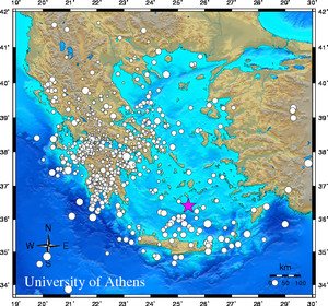
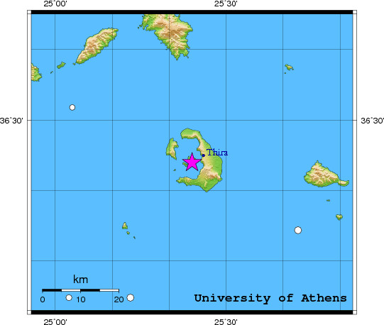
06 September 2011 (249) Dodecanese Islands, Greece
Location estimate (+/- standard deviation)
Origin time 23:04:22.2 +/- 0.5 sec
Latitude 36.40 N +/- 6.7 km
Longitude 25.40 E +/- 4.6 km
Depth 10.0 km (fixed)
Magnitudes:
ML=0.0 (0) ml=2.4 (9) mB=0.0 (0)
Median=2.5 (9)
90-Percent confidence region ellipse:
Semi-major axis 45.8 km strike: 26.1 deg
Semi-minor axis 24.1 km
Origin time error 2.5 sec
Autoloc alert ev110906230424: determined by 11 stations
LocSAT solution (with start solution, 11 stations used, weight 11):
Dodecanese Islands, Greece ml=2.4 2011/09/06 23:04:22 36.40 N 25.40 E 10 km
Stat Net Date Time Amp Per Res Dist Az ml ML mB
THR3 HT 11/09/06 23:04:24.6 22.3 1.6 -0.3 0.1 31 1.3 0.0 0.0
THR1 HT 11/09/06 23:04:25.0 17.3 1.3 0.1 0.1 124 1.3 0.0 0.0
EREA HA 11/09/06 23:04:59.6 8.0 1.7 -0.9 2.3 330 1.9 0.0 0.0
TRIZ HA 11/09/06 23:05:09.7 6.2 1.0 -4.0 3.3 308 2.5 0.0 0.0
KALE HA 11/09/06 23:05:10.2 10.6 1.3 -3.1 3.3 308 2.7 0.0 0.0
ALIK HA 11/09/06 23:05:10.5 0.8 0.3 -2.0 3.2 306 2.1 0.0 0.0
SERG HP 11/09/06 23:05:13.9 26.4 1.1 -0.3 3.3 308 3.2 0.0 0.0
LAKA HA 11/09/06 23:05:14.0 20.1 1.5 0.4 3.3 305 2.9 0.0 0.0
OUR HT 11/09/06 23:05:25.0 46.0 1.8 0.5 4.1 345 3.6 0.0 0.0
IGT HT 11/09/06 23:05:42.6 0.0 0.0 4.5 5.1 310 0.0 0.0 0.0
SGD HP 11/09/06 23:05:44.6 0.0 0.0 5.0 5.2 310 0.0 0.0 0.0
RMS-ERR: 1.58
First location: 2011/09/06 23:10:41 UTC
This location: 2011/09/06 23:10:42 UTC
|