Event-ID: ev101217221250
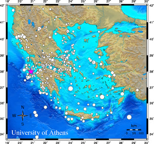
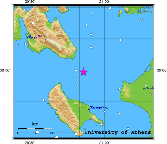
17 December 2010 (351) Ionian Sea
Location estimate (+/- standard deviation)
Origin time 22:12:47.8 +/- 0.5 sec
Latitude 37.99 N +/- 4.1 km
Longitude 20.86 E +/- 3.9 km
Depth 10.0 km (fixed)
Magnitudes:
ML=0.0 (0) ml=1.9 (12) mB=0.0 (0)
Median=1.9 (12)
90-Percent confidence region ellipse:
Semi-major axis 36.0 km strike: 42.3 deg
Semi-minor axis 20.8 km
Origin time error 2.7 sec
Autoloc alert ev101217221250: determined by 12 stations
LocSAT solution (with start solution, 12 stations used, weight 12):
Ionian Sea ml=1.9 2010/12/17 22:12:47 37.99 N 20.86 E 10 km
Stat Net Date Time Amp Per Res Dist Az ml ML mB
VLS HL 10/12/17 22:12:50.6 29.5 0.7 -3.7 0.3 311 1.9 0.0 0.0
KFL HP 10/12/17 22:12:52.4 65.8 0.8 0.5 0.1 334 2.1 0.0 0.0
DRO HP 10/12/17 22:12:56.7 15.0 1.1 -3.7 0.7 93 1.6 0.0 0.0
AMT HP 10/12/17 22:12:58.5 73.7 1.3 -4.1 0.8 124 2.3 0.0 0.0
LAKA HA 10/12/17 22:13:02.5 65.1 2.1 -1.7 0.9 74 2.1 0.0 0.0
KALE HA 10/12/17 22:13:07.4 18.4 2.1 0.4 1.1 68 1.6 0.0 0.0
EVR HL 10/12/17 22:13:09.2 25.9 2.6 0.6 1.2 38 1.7 0.0 0.0
EFP HP 10/12/17 22:13:09.3 25.3 1.8 4.7 0.9 62 1.7 0.0 0.0
MAKR HA 10/12/17 22:13:11.8 19.4 1.7 -0.7 1.4 44 1.9 0.0 0.0
PYL HP 10/12/17 22:13:15.9 24.9 1.9 5.6 1.3 147 1.9 0.0 0.0
IGT HT 10/12/17 22:13:19.4 18.0 1.6 4.3 1.6 345 1.9 0.0 0.0
NEST HT 10/12/17 22:13:25.2 6.6 2.2 -2.2 2.4 3 1.8 0.0 0.0
RMS-ERR: 1.63
First location: 2010/12/17 22:14:23 UTC
This location: 2010/12/17 22:14:24 UTC
|