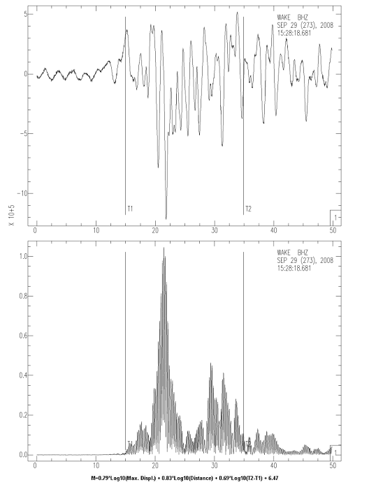
A strong earthquake of magnitude Mw=7.0 occurred eastern from Australia near Kermadec Islands on 29
September 2008 (15:19:31 GMT). The focal mechanism solution showed thrust type faulting.
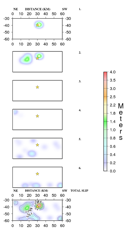
The inversion of teleseismic waves showed that the earthquake ruptured a fault with almost 30 km length.
The calculated slip model revealed several seismic sources.
Estimated magnitude M=7 based on the formula of Hara T., 2007
Slip model by Agalos A. email: aagalos@geol.uoa.gr
References
Agalos A., Papadimitriou P., Makropoulos K., 2008. Rupture Histories of Strong Earthquakes.
31st General Assembly of the European Seismological Commission, held at the Creta Maris
Conference Center, Hersonissos, Crete Greece, Book of Short papers, p 9-16.
Bassin, C., Laske, G. and Masters, G., 2000. The Current Limits of Resolution for Surface Wave Tomography
in North America, EOS Trans AGU, 81, F897.
Bouchon Michel, (1981). A simple method to calculate Green's functions for elastic layered media. BSSA, 71, 4, 959-971.
Hara, T., Measurement of duration of high-frequency energy radiation and its application to determination of
magnitudes of large shallow earthquakes, Earth Planets Space, 59, 227-231, 2007a.
Hara, T., Magnitude determination using duration of high frequency energy radiation and displacement amplitude:
application to tsunami earthquakes, Earth Planets Space, 59, 561-565, 2007b.
Harris, R., A., and Simpson R., W., (2002). The 1999 MW 7.1 Hector Mine, California Earthquake - A test of the stress
shadow hypothesis? BSSA, 92, 4, 1497-1512.
Hartzell S. H., and Heaton T. H., 1983. Inversion of strong ground motion and teleseismic waveform
data for the fault rupture history of the 1979 Imperial Valley, California, earthquake. BSSA, 73, 1553_1583.
Moshou A., Papadimitriou P., Makropoulos K., 2008. Waveform Inversion using Teleseismic and
Regional Data for Earthquakes that Occurred in Greece. 31st General Assembly of the European
Seismological Commission, held at the Creta Maris Conference Center, Hersonissos, Crete Greece,
Book of abstracts, p 95.
Wessel, P. and W. H. F. Smith., 1991. Free software helps map and display data, EOS Trans. AGU, 72, 441.